
Archive Record
Images
Metadata
Object ID |
2015.014.318 |
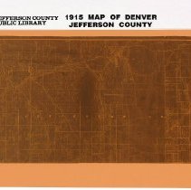
Title |
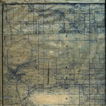
Color negative microform of 1915 map of west Denver, Jefferson County |
Accession number |
2015.014 |
Object Name |
Microform |
Scope & Content |
Color negative microform of 1915 map of west Denver, but mostly Jefferson County. Includes towns of Golden, Morrison, and Arvada. Map highlights major land owners, roads, railroads and irrigation ditches, along with natural features like North and South Table Mountains, Clear Creek and Green Mountain. Map includes Leyden to the north and Turkey Creek Canyon to the south. Sheridan Boulevard is the eastern boundary. Microform was created by Jefferson County Public Library. Original source is unknown. |
Search Terms |
Clear Creek Lookout Mountain Park Mount Vernon Canyon Pleasant View |