Search Term Record
Metadata
Name |
Fairmount |
Details |
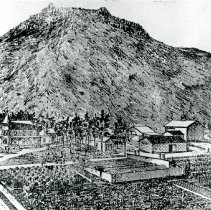
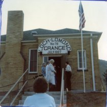
Fairmount lies east of North Table Mountain, between Ward Road and Easley Road from West 44th Avenue to West 60th Avenue. Approximately seven square miles in size, it is bounded by Arvada and Wheat Ridge on the north, east, and south, and by Golden to the west. Through it flow the Church, Croke, And Farmers Highline canals from which branch many irrigation ditches. At Fairmount's southern edge is Clear Creek, site of gold prospecting and early agricultural activity. Today, the former valley contains: four-lane State Highway 58 and an access road; the Coors industrial complex that extends along Clear Creek between Golden and Fairmount; and railtracks and the railroad spur that serve Coors' manufacturing and brewing facilities. East of McIntyre Street, Clear Creek flows through large reservoirs, former gravel pits, now filled with water. Fairmount and the Clear Creek Valley were settled with homestead claims in the early 1860s. To aid farming and ranching, settlers organized irrigation companies to build canals and ditches. Parts of Fairmount were platted as agricultural subdivisions in the late 1800s and early 1900s. Arvada Fruit Gardens, Wheat Ridge Gardens, Fairview Fruit Gardens, and New Hampshire Gardens originated as five- to ten-acre parcels intended for farm use. Despite access to water, cultivation was difficult because of the clay soil and stony terrain in much of Fairmount. For example, the Rockdale Fruit Farm on the south side of West 44th acquired the name because the acreage was so rocky. From Reconnaissance Survey Report 1999-2002 Cultural Resource Survey of Unincorporated Jefferson County Presented by Preservatin Publishing |
Related Records
-
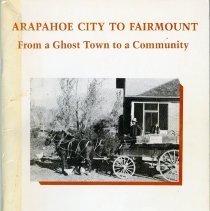
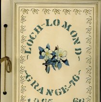
1990.014 - Arapahoe City to Fairmount: From a Ghost Town to a Community
1990.014
Record Type: Library
-
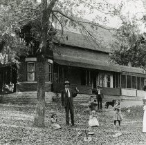
2011.099.335 - Easley Family eating watermelon in front of the Orchard House
2011.099
Record Type: Photographs
-
-

-
-
-
-
-

-
-
-
-
-
-
-
-
-
-
-